Chiredzi
 |
* Chiredzi is served by a small international airport at Buffalo Range called "Buffalo Range Airport," or "BFO."
* The non-profit organization, Elias Fund, has its Zimbabwean base of operations in Chiredzi. The Mashoko / Hippo Valley Christian Mission also had headquarters in Chiredzi, from which it oversees two orphanages and a number of schools and churches throughout the province.
* The Hippo Valley Estates is located here, with its A-school and private school, that is Hippo Valley Primary school. South Eastern College is also located in Chiredzi, and serves as the only A-rated private high school in the area.
* Hippo Valley Hospital is one of a number of centers for the treatment of HIV or AIDS in the province.
Map - Chiredzi
Map


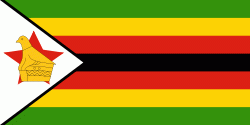
Country - Zimbabwe
 |
 |
| Flag of Zimbabwe | |
The British South Africa Company of Cecil Rhodes demarcated the Rhodesia region in 1890 when they conquered Mashonaland and later in 1893 Matabeleland after a fierce resistance by Matabele people known as the First Matabele War. Company rule ended in 1923 with the establishment of Southern Rhodesia as a self-governing British colony. In 1965, the white minority government unilaterally declared independence as Rhodesia. The state endured international isolation and a 15-year guerrilla war with black nationalist forces; this culminated in a peace agreement that established universal enfranchisement and de jure sovereignty as Zimbabwe in April 1980. Zimbabwe then joined the Commonwealth of Nations, from which it was suspended in 2002 for breaches of international law by its government under Robert Mugabe and from which it withdrew in December 2003.
Currency / Language
| ISO | Currency | Symbol | Significant figures |
|---|---|---|---|
| ZWL | Zimbabwean dollar | 2 |
| ISO | Language |
|---|---|
| SN | Shona language |